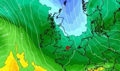
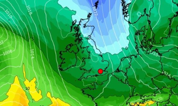
Temperatures could plunge next week as a summer of brutal heat comes to a close, according to weather maps. Forecast data collected by WXCHARTS.COM from this morning shows much of the British Isles experiencing cold weatherwith temperatures below 10C at 6am UST (7am BST) on Friday, September 19.
Maps show major English cities, including London and Birmingham, seemingly set for lows of between 8 and 10C, with 9C minimums in areas along the south coast and up into the double digits towards the sea. In various areas in parts of the Midlands, South West, South East, Anglia, and Yorkshire and the Humber, the mercury may drop as low as 7C at this time.
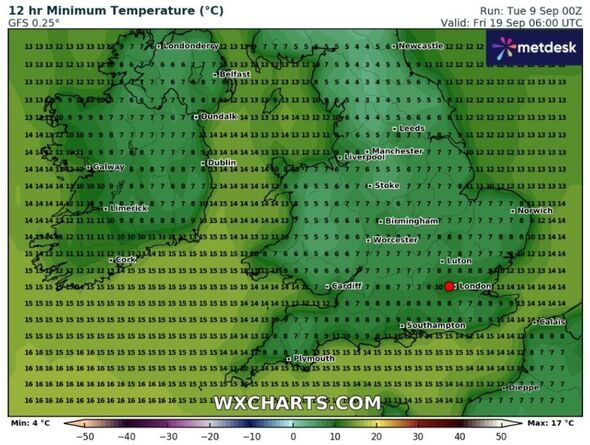
However, in places like Stoke, temperatures could be as low 6C and 5C, as well as around the Peak District and lower in some areas north of Leeds.
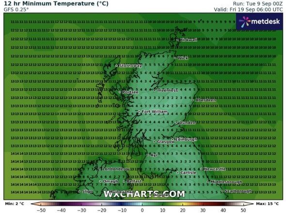
According to weather maps, temperatures look set to be considerably cooler around Yorkshire Dales National Park (where a minimum of 3C was forecast) and as well as in the northernmost parts of England bordering Scotland, and in southern Scotland itself.
Parts of Moray, Aberdeenshire, southeastern parts of The Highlands, and Perth and Kinross looked set to see the mercury drop as low as 2C.
The seven coldest cities in the UK looked set to include Scarborough (5C), Carlisle (5C), Middlesbrough (around 5C) Inverness (between 4 and 5C), Dundee (5C), and Glasgow (between 5 and 6C). Areas around Aberdeen were also forecast for between 4 and 5C though it looks set to be warmer off the coast.
The lowest temperatures in Wales looked set to range between around 5 and 7C in most areas, but minimums were as high as 15C on the southwest coast.
Meanwhile, minimum temperatures in Northern Ireland looked set to range between 6 and 8 °C at this time.
However, forecasts change frequently and are difficult to predict from days out so it's important to stay up to date with the latest forecasts and warnings nearer the time.
The Met Office's long range forcast covering Saturday, September 13 to Monday the 22nd ancticipates that conditions will be generally unsettled "with low pressure dominating much of the period".
"This will mean showers or longer spells of rain will affect most of the UK at times. A deep low likely crosses the country later on the weekend clearing early next week bringing heavy rain and strong winds," the Government agency adds.
"Following this a return to showers with periods of longer spells of rain is likely. Thunderstorms and hail are also possible, as are some spells of strong winds, especially if further deeper lows affect the UK.
"Later in the period, there may be some spells of drier weather that develop, especially towards the south, with more in the way of sunshine. Temperatures will likely be close to average or slightly below overall, but may rise above at times in drier, sunnier spells," it says.
-
Mumbai Accident: 63-Year-Old Woman Dies After Water Tanker Hits Scooter In Jogeshwari East

-
Harry Kane fans urged to check wallets as rare fivers worth fortune still in circulation
-
Northeast CMs hail Radhakrishnan's victory, say new VP will uphold democratic values

-
Promise Of Ayushman Card: Conmen Lure Residents Of Two Colonies Into Sharing ID, Biometrics In Madhya Pradesh

-
No question of withdrawal of govt decision on providing Kunbi certificates to Marathas: Maha Minister