Brits are being warned to prepare for winds of up to 80mph as raging storms are set to hit the country in days.
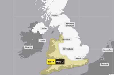
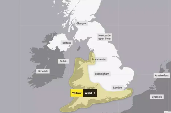
A yellow weather warning for wind, covering a large part of west and South West England and Wales as well as all of the southern coast of England, has been issued by the Met Office from 8pm on Sunday to 6pm on Monday. The alert stretches from southern England along the west coast of the UK and up to around Manchester with gusts of up to 60mph expected around coasts and hills, according to the weather service.
Gusts of up to 80mph are also possible in the most exposed locations with the windiest conditions expected on Monday morning, the Met Office said.
READ MORE: Met Office tells Brits in 49 areas to 'prepare' 3 essential items for 22 hours
READ MORE: Exact date Brits to bask in 25C Indian summer as weather maps turn bright red
Delays to transport are likely, along with a small chance of injuries and danger to life from flying debris, the forecaster added. The Met Office has advised those in the alert area to prepare by protecting their property including securing loose items outside properties including bins, sheds, fences and garden furniture.
In the build up to the stormy weather, breezy conditions are expected on Friday with overnight showers in western coastal areas before potentially heavy downpours and isolated thunderstorms on Saturday.
Stronger winds and coastal gales are also possible, according to the Met Office. Despite the unpredictable conditions, forecasters say they are not expecting a named storm to the hit the country.
Sunshine and drier conditions are most likely to be found in the east, though temperatures will remain on the cooler side, with highs of around 17C to 18C expected in London on both Saturday and Sunday.
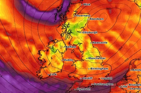
Paul Gundersen, chief meteorologist at the Met Office, said: “We have been monitoring a deepening area of low pressure over the North Atlantic that might bring impactful weather to the UK, most likely on Sunday and Monday. At present, a named storm is unlikely.”
RAC Breakdown spokesperson Alice Simpson said it was “vital” for drivers in the south and west of the country to keep an eye on the forecast given the “unsettled” weather.
She added: “Coastal regions with sea breezes are far more affected by windy conditions, so it’s in these areas where motorists are far more likely to be blown off course or into oncoming traffic.
“We’re advising all drivers to ‘slow down to stay safe’ and be wary of branches and debris in the road that could represent a hazard or obstruct journeys. Standing water and floods should be avoided at all costs unless drivers are sure the water is shallow enough to drive through safely.”
-
Man experiencing electric shock-like facial pain for over 10 years gets relief

-
Not all sunscreens are safe for every skin type: Dermatologist reveals 6 hidden side effects

-
Leave the film, Sanjay Dutt makes big money from alcohol, printed for 4 months, so many crores

-
Gulmarg in January and Lakshadweep in December … These places of the country roam every month

-
Morgan Stanley Reportedly Expects 4 Rate Cuts Through January, Says Fed Will Aim To Arrive At Neutral Rates ‘More Decisively’