Heavy snow is set to return to several areas of the UK before this weekend after the Met Office issued another wintry prediction just days after its last batch of snow warnings.
The Met Office has today forecast that snow will affect England, Wales, Northern Ireland and Scotland this Friday, mostly up north and on higher ground, hitting several counties and regions.
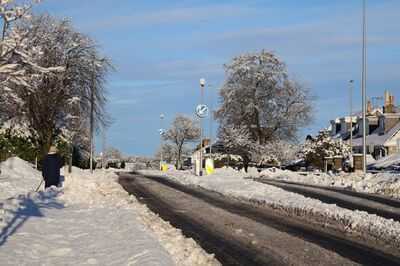
The Met Office's snow maps show the areas which are expected to see snow, with heavy snow over 4mm an hour possible up on the hills in the early hours of Friday, January 30.
At the same time, yet more heavy rain is forecast for much of the rest of the country, especially along the east coast and in the North as well as the South East.

The Met Office said in its forecast for Thursday: "Rather cloudy and breezy with some rain and hill snow lingering in the northeast, whilst showers give way to more persistent rain towards the southwest. Some brighter breaks developing elsewhere."
And for Friday to Sunday it added: "Friday looks unsettled with brisk winds. Rather cloudy skies giving outbreaks of rain for many. Brighter and becoming less breezy for most over the weekend, albeit with scattered showers still."
The full list of 25 areas of England, Wales, Scotland and Northern Ireland facing potential snow based on the Met Office's forecast map are:
As part of its advice on preparing for disruption, the forecaster says: "Snowy, wintry weather can cause delays and make driving conditions dangerous. Keep yourself and others safe by planning your route, giving yourself extra time for your journey. Check for road closures or delays to public transport and amend plans if necessary.
"If driving, make sure you have some essentials in your car in the event of any delays (e.g. warm clothing, food, water, a blanket, a torch, ice scraper/de-icer, a warning triangle, high visibility vest and an in-car phone charger).
"Check if your property could be at risk of flooding. If so, consider preparing a flood plan and an emergency flood kit.
"Give yourself the best chance of avoiding delays by checking road conditions if driving, or bus and train timetables, amending your travel plans if necessary.
"People cope better with power cuts when they have prepared for them in advance. It's easy to do; consider gathering torches and batteries, a mobile phone power pack and other essential items."
-
No Toilets, No Recognition: Supreme Court Lays Down School Hygiene Mandate

-
Khushi Kapoor Makes The Case For Dior's Viral 'Bow-Bag' At Paris Fashion Week

-
US Man Quits Six-Figure Job After Company Denies Paid Leave For Brain Cancer Treatment: Says, 'We Need To Reform Workplaces'

-
Drivers urged to 'rub a potato' over car windscreens this week

-
'Urgent concern' for missing Brit last seen in Spanish holiday hotspot as appeal launched