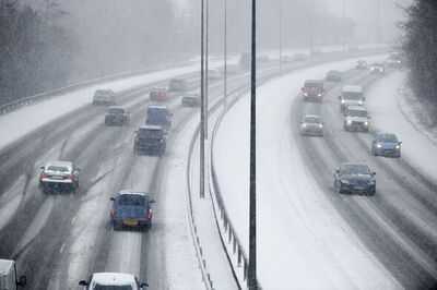
Snow warnings have been in place in England, Scotland and Wales over several days this week but even though the Met Office snow alerts have now passed, more is forecast to fall on various parts of the UK in the hours and days to come.
The weather experts issued yellow weather warnings for snow in England, Scotland and Wales on Tuesday night into Wednesday morning, followed by yellow warnings for rain in the south of England and Scotland to take effect from 5am on Thursday.
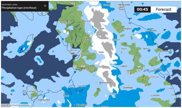
Although there is not yet a formal warning in place for snow on Thursday or Friday, the Met Office's weather maps show that snow is forecast to return once more in various parts of England, Scotland and Wales in the early hours of Friday morning, especially on higher ground and more rural areas.
The Met Office's forecast for Thursday says: "Rain moves northwards through the day, turning heavy in places and again, possible snow across north Wales, the Pennines and Scottish mountains. Winds staying strong in the north. Average temperatures."
And for Friday, it predicts: "Wintry hazards continuing for the northern half of the UK, with outbreaks of rain in the south. Some drier spells on Saturday, but remaining mostly cloudy into the weekend."
The Met Office's forecast maps show snow could hit the UK early on Thursday morning in some areas, before spreading across much of Scotland and northern England throughout Thursday and peaking at about 1am on Friday morning.
Then, the snow will gradually beat a retreat in the early hours of Friday and be confined to the remote areas of northern Scotland by Saturday morning.
The list of 29 areas expecting to see snow on Friday according to the Met Office maps are:
Manchester
Burnley
Skipton
Bradford
Hawes
Alston
Leyburn
Middleton-in-Teasdale
Stanhope
Brough
Edale
Huddersfield
Sheffield
Rochdale
Bangor
Jedburgh
Edinburgh
Biggar
Kinross
Strathyre
Loch Rannoch
Pitlochry
Aberlour
Aberdeen
Ullapool
Lairg
Craigtown
Wick
Dunbeath
The Met Office, in its longer range forecast, says that next week, from Monday, February 9 onwards, the biggest risks will be rain and flooding but that snow could still return once more, especially in England and Scotland.
It says: "Cyclonic patterns are expected to dominate across the UK during mid-February. Frontal systems over the Atlantic are likely to approach the UK at times, tending to become slow moving as they encounter a blocking area of high pressure to the northeast. This will result in showers or longer spells of rain spreading across the UK, these heavy at times. Rainfall amounts will probably be highest in parts of the west, including across areas already sensitive to flooding.
"As these bands of rain spread northwards, snow is possible across northern England and Scotland, mainly over high ground. Strong winds could develop in places, especially coasts. Temperatures will probably be close to normal overall, with any cold conditions more likely in the north."
-
T20I batting Rankings: Ishan Kishan left 32 players behind, Sanju Samson in very bad condition

-
The army of Kauravas was bigger than that of Pandavas, yet why was Duryodhana frightened? Know an interesting story, – News Himachali News Himachali

-
RKLB, ASTS Stocks Dip Amid Selloff After SpaceX-xAI Merger Spurred Rally

-
Is it okay to chant mantra in bed? From chanting Ram’s name to Gayatri Mantra, know its advantages and disadvantages and the correct method of chanting mantra – News Himachali News Himachali

-
Rajasthan: 4.9 kg Mephedrone seized in Jodhpur, 3 held by NCB, police