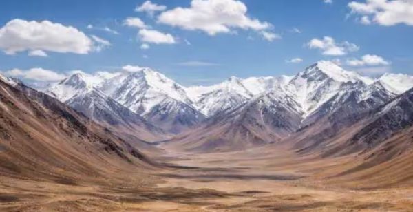
**Aksai Chin** is a high-altitude desert plateau at the intersection of the Himalayas and the Karakoram ranges, with an average elevation of about **4,300 metres** (lowest elevation near the Karakash River). Its name, of Uyghur/Turkic origin, is usually interpreted to mean “desert of white stone” or “desert of white ravines” (“chin” being interpreted as “China” or “pass/ditch”); Claims of “true valley white desert” seem illustrative but are not standard.
Historically, the region was connected to **Ladakh** (ancient Maryul Kingdom), where there is evidence of Neolithic habitation and nomadic use for grazing and trade along the Silk Road routes by groups such as the Kampa and Brokpa. **Senge Namgyal**, king of Ladakh (early 17th century), extended his control over the northern regions, and established the traditional boundaries that India refers to today. It was never a true “no-man’s land,” but rather sparsely populated, where Ladakhi villagers mined salt and grazed cattle.
In the 19th century, after the conquest of Ladakh by the Sikhs/Dogras (1834–1842) and the British annexation (1846), the boundaries were formalized. W.H. Johnson’s 1865 line placed Aksai Chin with the Kunlun mountains in Jammu and Kashmir. The Ardagh (or Johnson-Ardagh) Line of 1897 referred to it as a defensive boundary against Russian threats, which British India maintained until 1947. The Maharajas maintained posts like Shahidullah and included this area in the revenue records of Ladakh.
After 1947, India claimed Aksai Chin based on these lines. In the 1950s, China secretly built a highway (now G219) that connected Xinjiang and Tibet through the plateau (construction ~1951–1957, opened in 1957). India became aware of it through patrols and Chinese maps in 1957–1958, and protested against incursions into the claimed territory. This led to the **India-China War of 1962**, after which China retained control (~38,000 sq km), and established the **Line of Actual Control (LAC)**. India never gave up its claim, and considers Aksai Chin an integral part of Ladakh. Strategically important, the region provides China with a secure Xinjiang-Tibet link and surveillance facilities from high altitudes. For India, it controls the headwaters of important rivers (e.g., Karakash) for water security and keeps an eye on Ladakh for northern defence. After the 2020 Galwan clash, India stepped up work on infrastructure – roads, bridges, airports – in Ladakh to strengthen its presence and assert its claims amid the ongoing tensions along the LAC.
China administers Aksai Chin as part of Xinjiang/Tibet; India maintains sovereignty claims diplomatically and by exerting military power.