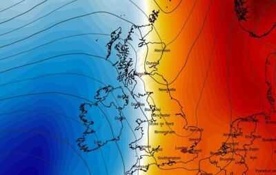
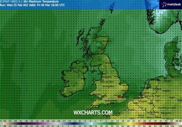
The UK looks set for a three-day-long springtime scorcher within days, with top temperatures reaching a balmy 18C for some. Weather maps generated by forecaster WX Charts today (February 25) show the UK basking in warmer weather from March 6 to 8.
England, Wales and Northern Ireland could see maximum temperatures ranging from 11-17C by 6pm on March 6, with parts of Norfolk possibly seeing 17C, WX Charts' maps show. It will be a bit cooler in Scotland where 7-9C is forecast in the west, but 13-14C in the east. The heat turns up a degree or two for some by March 7, with WX Charts showing a high of 18C in Norfolk and Cambridgeshire by 6pm on that date.
Elsewhere, the mercury looks set to rise to 14-17C for much of England and parts of Wales. If the modelling proves to be accurate this far ahead, then Brits in England especially can expect top temperatures of 15-17C by 6pm the following day, WX Charts' maps show.
The latest maps come as the UK saw its hottest day of the year so far on Wednesday (February 25). Kew Gardens in south west London recorded the highest temperature in the UK with 18.7C, according to the Met Office.
The forecaster said that it is the highest temperature recorded in the country in February since February 27, 2019, when 19.2C was logged at Heathrow.
Before that, 21.2C was logged in Kew Gardens on February 26 the same year. That remains the highest temperature recorded in February in the UK.
While some Brits will have enjoyed a break from the rain and cold weather, the current spell of sunshine and drier weather is not expected to last. Temperatures are set to drop from Thursday.
Dan Harris, chief forecaster at the Met Office, said: "A brief period of southerly winds has drawn in some warmer and drier air.
"This has enabled cloud to clear across many parts of England and Wales, and with the sun at this time of year beginning to gather a bit of strength it has warmed the air that bit more."
Mr Harris added: "Temperatures across much of the UK are expected to drop tomorrow (Thursday), relative to today, as winds become more westerly.
"This means a greater influence of moister, Atlantic air, which is likely to be both cooler and contain more cloud."
Brits could see highs of 12C to 14C in most of England and Wales, 12C in Northern Ireland, and 10C to 11C in Scotland, according to the Met Office.
The forecaster said there should be a "bright start in the east", but skies across the country should be generally cloudy, with outbreaks of rain turning heavier and more persistent in the west.
Many parts of the UK are expected to be "unsettled with rain" on Friday, making way for some brighter spells on Saturday, but with some showers.
Cloud and rain will likely return from the west on Sunday, according to the forecaster. Meteorological spring begins on March 1 and ends on May 31.
-
Julia Bradbury shares sad health update after death admission: 'Trying to survive'

-
New Zealanders let slip time ex-Prince Andrew 'threw a tantrum' in embarrassing moment

-
Former Prime Minister named in Epstein Files rushed to hospital after 'suicide attempt'

-
Epstein's 9-word swipe at King Charles after major Andrew decision

-
5 Devotees Lord Hanuman Protects Instantly