Nearly ten years after the launch of Pokémon Go turned everyday streets and parks into digital playgrounds, the massive trove of data generated by its players is being used for something entirely different. What began as an augmented reality game encouraging people to hunt for virtual creatures in real-world locations is now helping autonomous delivery robots move through city streets with greater accuracy.
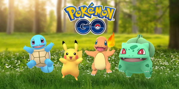
The game, developed by Niantic, quickly became one of the most successful mobile apps ever released when it debuted in 2016. Millions of players walked around neighborhoods, parks, and public spaces using their smartphones to locate digital characters like Pikachu and Charizard that appeared on their phone screens through augmented reality.
At the time, the goal was simple: catch Pokémon and explore the world. But all the photos, scans, and environmental data captured during gameplay ended up creating an enormous visual database of real-world locations. That database is now being used to train technology designed for a very different task—guiding delivery robots.
Recently, Niantic Spatial, the mapping and spatial computing division of Niantic, announced a partnership with robotics startup Coco Robotics. The collaboration aims to help small autonomous delivery machines navigate sidewalks more effectively using Niantic’s mapping technology.
Turning Gameplay Into a Global Mapping Tool
When Pokémon Go first appeared on smartphones, it introduced many people to augmented reality gaming. The app used a phone’s camera and GPS to overlay animated creatures onto the real world, making it seem as though Pokémon were hiding in parks, near monuments, or along city streets.
Players were encouraged to move around in the real world to discover these creatures and interact with game locations. This meant millions of people were constantly pointing their phone cameras at buildings, statues, landmarks, and other parts of the environment.
Although the activity felt like simple gameplay, it was also generating enormous amounts of visual information about real-world locations. Niantic reports that the company has collected more than 30 billion images from Pokémon Go players over the years.
These images have been used to train Niantic’s Visual Positioning System, commonly known as VPS. Unlike traditional navigation methods that rely primarily on satellite signals, VPS determines where something is by analyzing visual details from the surrounding environment.
By comparing camera images with previously stored photos of the same locations, the system can determine a device’s position with remarkable precision. In some cases, it can identify a location within just a few centimeters.
Game Features That Expanded the Data Collection
Niantic expanded the data collection process in 2020 when it introduced a feature within the game that encouraged players to scan real-world landmarks. The activity allowed users to capture images of statues, public art, and other notable locations using their phone cameras.
Players who completed these scans received in-game rewards, giving them an incentive to participate. Over time, these contributions helped Niantic build detailed three-dimensional models of real-world environments.
Additional images were also captured at locations where players frequently gathered for in-game activities, such as battle arenas. Because so many players visited the same spots repeatedly, Niantic ended up with thousands of photos of the same landmarks taken from different angles, heights, and lighting conditions.
This variety turned out to be extremely valuable. By analyzing images captured at different times of day and in different weather conditions, the system became better at recognizing locations in a wide range of situations.
The result is a detailed digital representation of many real-world spaces that continues to grow as more data is added.
A New Navigation Tool for Delivery Robots
For Coco Robotics, the technology could solve one of the biggest challenges facing autonomous delivery machines: finding their way through complicated urban environments.
Most delivery robots today rely heavily on GPS signals to navigate. While GPS works well in open areas, it can become unreliable in cities where tall buildings block or interfere with satellite signals. In these situations, location data may drift or become inaccurate.
This problem—sometimes called the “urban canyon” effect—can cause robots to misjudge their position or struggle to reach their destination. Even robots operating in controlled environments, such as university campuses, have occasionally had difficulty navigating intersections or avoiding obstacles.
Niantic’s Visual Positioning System provides another layer of navigation. Coco’s robots are equipped with multiple cameras that continuously observe the surrounding environment. By comparing what the robot sees with Niantic’s massive image database, the system can determine exactly where the robot is.
This visual recognition method allows robots to stay on course even when GPS signals are unreliable. For delivery services, that could translate into faster and more reliable drop-offs for food and grocery orders.
Crowdsourced Data Finds Unexpected Uses
The reuse of Pokémon Go player data illustrates a broader pattern in the technology industry: information gathered for one purpose often becomes valuable for something else later on.
Over the years, similar examples have emerged in other digital platforms. Tasks that appear simple to users—such as identifying objects in images—can help train artificial intelligence systems. For instance, systems like Google CAPTCHA have long been associated with training computer vision technologies.
Crowdsourced navigation apps have also played a role in gathering real-world data. Information submitted by drivers using the navigation platform Waze has sometimes been used in ways that go beyond basic traffic updates, including supporting investigations or data analysis.
Although Niantic has not indicated that its VPS mapping data will be shared outside its own projects, the technology demonstrates how large datasets created by everyday users can take on new roles over time.
-
Oscars 2026: Check The Full List Of Winners Here

-
The Other Bennet Sister viewers all say the same thing as BBC drama begins

-
Michael Carrick forces Roy Keane U-turn as Man Utd close in on Champions League return

-
Victims of fatal UK meningitis outbreak 'all attended same event' as 11 still in hospital

-
Controversial Police Arrest Video Sparks Community Outrage in Daytona Beach