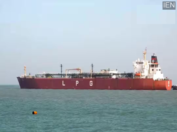
Maritime traffic relies entirely on technology, navigation systems, and international regulations—particularly on sensitive routes like the Strait of Hormuz, through which a significant portion of the world’s oil and gas passes.
The impact of the ongoing tensions between the U.S., Israel, and Iran is being felt across the globe. In fact, 20 percent of the world’s oil and gas tankers pass through the Strait of Hormuz, located near Iran. Consequently, due to the current tensions, many ships are currently unable to traverse the Strait of Hormuz—a situation whose repercussions are being witnessed in countries worldwide. Amidst this disruption to maritime traffic, various questions are arising in people’s minds: How exactly do ships determine their direction in the middle of the ocean, without roads or signboards? And how is the journey from Iran to India completed? Today, let us explain how ships at sea determine whether to turn left or right, and how vessels successfully make the voyage from Iran to India.
Communication via Radio and Satellite
Maritime traffic relies entirely on technology, navigation systems, and international regulations—particularly on sensitive routes like the Strait of Hormuz, through which a significant portion of the world’s oil and gas passes. Every movement in such areas is executed with extreme caution. Furthermore, radio communication plays a pivotal role in maintaining contact between ships at sea. Through this medium, nearby vessels exchange information regarding their direction, potential hazards, or intended routes. Once ships venture far from the coastline, satellite communication is utilized. This enables ships—even when thousands of kilometers away—to remain connected with control rooms and other vessels, ensuring that immediate information is available in any situation.
AIS Provides Precise Location Data
Modern ships are equipped with an AIS—or Automatic Identification System. This system continuously transmits data regarding the ship’s location, speed, and direction. This allows nearby vessels and control centers to track the movements of specific ships and determine their intended course. This minimizes the risk of collisions or veering off course.
Direction is also determined using GPS, Radar, and a Compass.
To navigate the seas, ships employ various technologies: GPS provides precise location data, while radar detects nearby vessels and obstacles. Meanwhile, a compass is used to determine direction. With the aid of all these systems, ships determine whether to steer right or left. Furthermore, international maritime regulations designate specific lanes that must be strictly adhered to.
How do ships travel from Iran to India?
Ships departing from Iran first traverse the Strait of Hormuz, which is considered the world’s most critical oil shipping route. Subsequently, they enter the Arabian Sea and proceed toward India’s western coast. Typically, ships reach Kandla in Gujarat in approximately one to one-and-a-half days, and Mumbai in about two days. However, travel times may vary depending on weather conditions, maritime traffic, and security situations.
-
Veteran actor-director EA Rajendran dies at 71

-
Four Cities, One Tour: Paresh Pahuja's Love Notes Tour Is Arguably The Best Thing On Your Upcoming Calendar

-
Paresh Pahuja's Love Notes Tour Is Coming To Four Cities And Your Upcoming Calendar Should Make Room

-
13 killed in Andhra bus fire, CM Naidu condoles

-
IPL 2026: All-Indian Captains Set for Epic Clash — Who Will Outshine Whom?