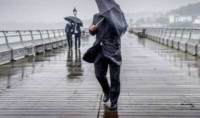
Easter weekend celebrations are predicted to be a washout this weekend as new weather maps show a huge front of wet weather sweeping across 20 UK cities.
The long narrow band of rain stretches the whole length of the UK from the far north of Scotland to the south coast of England. Cities seeing the heaviest rainfall in England appear to be mostly in the north, with Carlisle, Manchester, Liverpool, Newcastle, Leeds, Sunderland, York and Derby all in the firing line on April 4 and 5.
Wet weather is also likely to hit the Midlands and the South with Birmingham, Stoke, Coventry, Gloucester, Bristol and Bournemouth expecting a drenching. In Wales, Swansea appears in line for the most showers, with Cardiff perhaps set to escape the conditions over the Easter Weekend.
In Scotland, Perth, Edinburgh, Aberdeen and Dundee all look set to get a soaking, although the Scottish capital may get the least rainfall of the three. Across the sea in Northern Ireland, it looks like Belfast will escape the showers, leaving clear conditions for the religious and chocolate-egg-filled weekend.
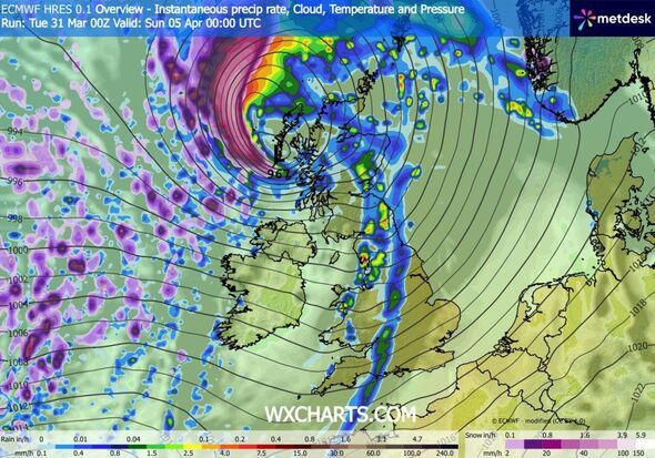
The April showers are predicted on new maps released by the forecasters WXCharts.
In a forecast beginning on April 4, the Met Office said the nation could expect "the potential for strong winds and heavy rain".
A statement from the national forecaster said: "It is increasingly likely that unsettled conditions will affect the UK over the Easter Holiday weekend, with the potential for strong winds and heavy rain at times.
"The wettest and windiest weather is more likely towards the west and north of the country.
"Beyond Easter, a broad northwest-southeast split is most likely, though the extent of high pressure into southern areas is unclear.
"That said, northern and western parts are more likely to remain rather unsettled overall, with further spells of wind and rain, and areas further southeast should see the best of the drier, clearer interludes.
"Temperatures probably fairly close to average overall, but occasional warmer spells are possible in the south."
Today:
The morning will start mostly cloudy with hill fog and patchy rain. Skies brightening somewhat, with some warm afternoon sunshine developing, especially to the east of high ground. Still a few showers though. Very mild, though windy in the north.
Tonight:
Clear spells overnight, especially in the east, with fog patches. However, cloud thick enough to give patchy drizzle further west. More persistent rain arriving in the northwest, where remaining windy.
Wednesday:
Rain will move southeast across Scotland and Northern Ireland, with brisk winds. Brighter in the northwest later. England and Wales mostly dry and cloudy, but occasional bright intervals and mild.
Outlook for Thursday to Saturday:
Rain clearing southeastwards on Thursday, then mostly fine. Further rain in the northwest later. Unsettled on Good Friday and Saturday. Spells of wet and windy weather sweeping across the UK.
-
New PAN Rules From April 1: All You Need To Know Before Applying

-
PBKS VS GT: Shreyas Iyer Wins Toss, Gujarat Titans Batting First In Mullanpur

-
Nagaland State Lottery Result: March 31, 2026, 8 PM Live - Watch Streaming Of Winners List Of Dear Destiny Sambad Night Tuesday Weekly Draw

-
Sikkim State Lottery Result: March 31, 2026, 6 PM Live - Watch Streaming Of Winners List Of Dear Prestige Tuesday Weekly Draw

-
Victorian cottage on sale for £450k has an incredible surprise in the garden