New Delhi: Odisha has become the first Indian state to roll out a Marine Spatial Plan (MSP), a significant step in India’s management of its coastal and ocean resources. The initiative is part of a broader India–Norway collaboration on sustainable ocean planning that began in 2019, with earlier pilot phases in Puducherry and Lakshadweep.
What is Marine Spatial Planning?
Marine Spatial Planning is a scientific, data-driven framework to organise human activities in marine areas. It maps the ocean and identifies which zones are best suited for different uses. These include fishing, tourism, shipping, conservation, or energy projects, and categorisations of the marine environment are done in accordance to these. It is also attempted that environmental damage and conflicts are minimised when this process is being done.
Experts study factors like water quality, biodiversity, seabed vegetation and climate conditions and based on these studies, they designate areas for different purposes. This in turn is used by the government to make judicious decisions.
The initiative aims to balance economic growth with environmental protection, while taking in consideration the social and cultural needs of coastal communities.
Why is it important?
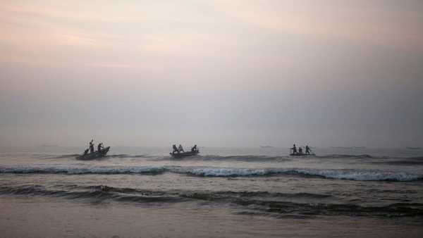
Odisha has a long coastline of over 550 km, rich in ecosystems like mangroves, lagoons, and estuaries. These areas support fisheries, tourism, and biodiversity, but are increasingly under pressure from development and climate change.
The Marine Spatial Plan is thus extremely important for a region like Odisha, as it will be bid aid in the state to balance its economical and ecological goals. For example, deciding where ports can expand without harming fishing zones or sensitive habitats, the initiative can help in finding a balance between the two important goals, which can often conflict in such areas.
Under the plan, agencies like the National Centre for Coastal Research will carry out detailed ocean mapping along Odisha’s coast and this data would help be used to inform policy decisions regarding maritime management.
-
Bulgaria Elections 2026: Former President Radev Leads As Nation Seeks Political Stability

-
PBKS VS LSG: Rishabh Pant Wins Toss, Lucknow Choose To Field In Mullanpur

-
Nagaland State Lottery Result: April 19, 2026, 8 PM Live - Watch Streaming Of Winners List Of Dear Magic Sambad Night Sunday Weekly Draw

-
Tabu Buys ₹10 Crore Luxury Apartment In Mumbai's Versova; Details Inside

-
Govt to set up 79 new dialysis centers in Telangana: Health minister