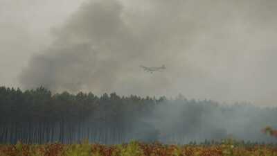
New Delhi: Massive wildfires raging across southwestern France have triggered an unusual and dangerous weather phenomenon, the ‘pyrocumulonimbus clouds’, more commonly known as ‘fire clouds’. For the first time on record, French authorities have confirmed that one of the country’s wildfires generated a full-fledged fire thunderstorm, producing lightning that ignited fresh blazes miles away from the original fire.
The phenomenon, more commonly seen during extreme wildfires in Australia, Canada and the western United States, has added a new layer of complexity to Europe’s worsening wildfire crisis.
What are pyrocumulonimbus clouds?A pyrocumulonimbus cloud is an intense thunderstorm that forms due to the large amounts of heat that is released by a wildfire, and not by the usual method of atmospheric heating.
The heat from an exceptionally large fire creates powerful updrafts, sending smoke, ash, water vapour and hot air several kilometres into the atmosphere. As this rising plume encounters cooler air at higher altitudes, the water vapour condenses around tiny particles of smoke and ash, forming towering cumulonimbus clouds. As such conditions sustain over a period of time the cloud then grows larger and larger in size.
Why do they produce lightning?Inside a pyrocumulonimbus cloud, violent upward and downward air currents cause ice crystals, ash and smoke particles to collide repeatedly. These collisions build up electrical charges in much the same way as they do inside a conventional thunderstorm.
The result is lightning, which can ignite entirely new wildfires several kilometres away from the original blaze.
The clouds also generate erratic winds which can rapidly change a wildfire’s direction, spread burning embers over long distances and endanger firefighters on the ground. In some cases, they may produce light rain or hail, but rarely enough to suppress the fire that created them.
Why is this concerning concerned?Pyrocumulonimbus clouds have historically been associated with catastrophic bushfires in Australia and major wildfires in North America. Their appearance in France is seen by scientists as another indication that Europe’s wildfire seasons are becoming more intense.
Rising temperatures, prolonged droughts and repeated heatwaves are creating the combination of dry vegetation and unstable atmospheric conditions needed for these fire-generated storms to develop. As fires grow larger and burn hotter, they are increasingly capable of creating their own weather, making suppression efforts significantly more difficult.
France and Spain battle Europe’s latest wildfire emergencyFrance’s Gironde region, southwest of Bordeaux, has been among the worst-hit areas, where authorities confirmed the country’s first recorded pyrocumulonimbus cloud. The wildfire, which began around July 22, has burned hundreds of square kilometres of forest, damaged or destroyed hundreds of homes and forced the evacuation of more than 200,000 people. Fire-generated lightning has ignited additional blazes, complicating firefighting operations.
Neighbouring Spain is also battling multiple major wildfires as another heatwave threatens the Iberian Peninsula. Firefighters have been deployed across several regions, with authorities warning that soaring temperatures, strong winds and exceptionally dry conditions could accelerate fire spread in the coming days. European governments have linked the increasingly severe wildfire seasons to climate change and are expanding firefighting resources as the crisis continues.
-
AC Milan legend and Italy World Cup winner Franco Baresi passes away

-
Bengaluru Woman Alleges Zepto Agent Kept Banging Door, Tried To Enter Her House; Sparks Safety Concern

-
Cristiano Ronaldo, Georgina Rodríguez Wedding Soon? Matching Diamond Rings Spark Buzz

-
Lokesh Kanagaraj’s ‘DC’ Hindi trailer out; Dharma to distribute

-
REC, PFC sign Rs 26,850 cr loan for 2,400 MW UP power expansion