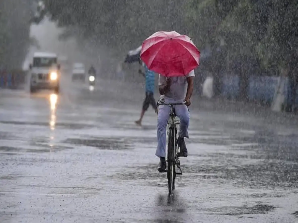
Weather Update August 14, 2026: Monsoon activity remains intense across several parts of India, with heavy rainfall, thunderstorms, lightning and gusty winds expected in multiple states on Friday, August 14. According to the forecast details, wind speeds could rise to around 70-80 kmph in isolated areas, while some locations may also experience hail.
The unsettled conditions could affect road travel, disrupt local transport and lead to waterlogging in low-lying areas. People living in vulnerable regions, particularly hilly areas, should remain cautious about the possibility of landslides, falling trees and sudden changes in weather.
Residents are advised to check local weather warnings before travelling and avoid unnecessary outdoor activity during thunderstorms.
Heavy Rain Alert Across Several States
Rain and thunderstorm activity is expected across a wide geographical area.
States and regions likely to experience unsettled weather include Delhi, Uttar Pradesh, Rajasthan, Bihar, Madhya Pradesh, Chhattisgarh, Himachal Pradesh, Uttarakhand, Haryana, Punjab, Maharashtra, Gujarat, Jharkhand, West Bengal and Odisha.
Some areas could witness intense spells of rain accompanied by lightning and strong surface winds. Gusts could reach 70-80 kmph at isolated locations, according to the forecast information.
The continuing spell of wet weather is also likely to keep daytime temperatures relatively lower in areas receiving persistent rainfall.
What's Driving the Current Weather?
The active monsoon conditions are being linked to weather systems affecting different parts of the country, including a cyclonic circulation over the northwest Bay of Bengal and adjoining areas.
Such systems can strengthen moisture flow and contribute to widespread rainfall over central, eastern, northern and western parts of India.
Local conditions can vary considerably, however, meaning one district could experience an intense downpour while a nearby area receives relatively moderate rainfall.
Delhi-NCR Weather Today
Delhi-NCR could experience a cloudy and unsettled Friday.
The region is expected to see generally cloudy skies, with the possibility of thunderstorms and spells of rain. Some periods of rainfall could turn intense, while gusty winds may accompany thunderstorm activity.
Delhi's maximum temperature is expected to remain around 34-36°C, while the minimum could hover between 27°C and 29°C.
People travelling across Delhi, Noida, Gurugram, Ghaziabad and neighbouring areas should account for possible traffic disruption and waterlogging during intense showers.
Drivers should also exercise extra caution when visibility falls during heavy rain.
Uttar Pradesh Weather: Rain and Thunderstorms Likely in Several Districts
A large part of Uttar Pradesh could remain under active monsoon conditions.
Areas that may experience rainfall and thunderstorms include Noida, Ghaziabad, Lucknow, Kanpur, Mathura, Agra, Gonda, Gorakhpur, Sant Kabir Nagar, Aligarh, Jhansi, Muzaffarnagar, Bahraich, Mirzapur, Jaunpur, Sonbhadra and Mau.
Some districts may receive heavy rainfall accompanied by lightning and gusty winds.
During stronger thunderstorm spells, wind speeds could rise to around 60 kmph in some areas.
Lucknow is expected to record a maximum temperature of around 32°C, while the minimum may remain close to 28°C.
Residents should avoid taking shelter under isolated trees during lightning and should stay away from exposed areas when thunderstorms intensify.
Rajasthan Weather: Heavy to Very Heavy Rain Possible
Rajasthan is another state where monsoon activity could remain strong.
Rainfall is expected across several eastern, southeastern and southern districts, with isolated locations potentially receiving heavy to very heavy showers.
Areas to watch include Jaipur, Udaipur, Ajmer, Kota, Tonk, Sawai Madhopur, Bundi, Pali, Bharatpur, Bhilwara, Baran, Sirohi, Pratapgarh, Banswara and Chittorgarh.
Thunderstorms and strong winds could accompany the rainfall at some places.
In Jaipur, the maximum temperature is expected to remain near 32°C, while the minimum could be around 26°C.
Motorists should remain particularly careful on waterlogged roads and avoid attempting to cross flooded underpasses or rapidly flowing water.
Maharashtra and Western India Could Also See Active Monsoon Conditions
Monsoon activity is also expected to remain significant over parts of western India.
Maharashtra and adjoining regions may receive further spells of rain, while weather conditions over parts of the western coast could remain rough during periods of stronger monsoon activity.
People in coastal areas should closely follow official local advisories, particularly where warnings are issued for rough sea conditions.
Fishermen should avoid venturing into areas where authorities have advised against marine activity because conditions at sea can deteriorate quickly during active weather systems.
Bihar Weather: Rain May Bring Temporary Relief From Heat
Bihar could also experience showers and thunderstorms during the day.
Patna's maximum temperature is expected to remain around 34°C, while the minimum could be close to 29°C.
Rainfall may provide temporary relief from humid conditions, although high moisture levels can keep the weather uncomfortable between showers.
Thunderstorms accompanied by lightning remain a concern during the monsoon season, so residents should move indoors when thunder is heard rather than waiting for rain to become intense.
Madhya Pradesh and Chhattisgarh Forecast
Central India is also expected to remain affected by active monsoon conditions.
Parts of Madhya Pradesh and Chhattisgarh could experience moderate to heavy rainfall, thunderstorms and lightning.
Bhopal is expected to remain considerably cooler than several northern cities, with a maximum temperature near 27°C and a minimum of around 24°C.
Persistent rainfall can increase the possibility of local waterlogging and overflowing drains, particularly in urban areas receiving repeated spells of heavy rain.
Himachal Pradesh and Uttarakhand Need Extra Caution
Heavy rainfall requires greater caution in Himalayan states because saturated slopes can increase the threat of landslides and falling rocks.
People travelling through Himachal Pradesh and Uttarakhand should check road and weather conditions before starting their journey.
Tourists should avoid approaching swollen rivers, waterfalls and unstable slopes during or immediately after heavy rain.
Even when rainfall stops temporarily, runoff from higher elevations can cause water levels in streams and rivers to rise quickly.
Weather Forecast for Major Cities on August 14
Here is the temperature outlook mentioned for some major cities:
| City | Maximum Temperature | Minimum Temperature |
|---|---|---|
| Delhi | 34-36°C | 27-29°C |
| Mumbai | Around 30°C | Around 27°C |
| Chennai | Around 36°C | Around 28°C |
| Kolkata | Around 31°C | Around 27°C |
| Lucknow | Around 32°C | Around 28°C |
| Patna | Around 34°C | Around 29°C |
| Bhopal | Around 27°C | Around 24°C |
Actual temperatures can vary depending on rainfall intensity, cloud cover and local weather conditions.
What to Do During Heavy Rain and Strong Winds
People in affected regions should keep an eye on short-term local warnings because thunderstorm conditions can develop rapidly.
Avoid standing near trees, electric poles, temporary structures or large hoardings during strong winds. Stay indoors during lightning wherever possible and unplug sensitive electrical equipment if severe thunderstorms are occurring nearby.
Drivers should reduce speed during intense rain and maintain additional distance from other vehicles.
Never attempt to drive through a heavily flooded road if the depth or current cannot be assessed safely.
People living in areas prone to flooding or landslides should follow instructions issued by local administrations and disaster-management authorities.
August 14 Weather Outlook: Monsoon Remains Active
The overall weather pattern suggests that August 14 could remain wet and stormy across several parts of India, with conditions varying from moderate showers to intense rainfall and thunderstorms.
Delhi-NCR, Uttar Pradesh, Rajasthan, Bihar, Madhya Pradesh, Chhattisgarh and several other states are among the regions where residents should remain prepared for changing weather.
With wind speeds potentially reaching 70-80 kmph at isolated locations, thunderstorms could also create risks from falling branches, temporary structures and reduced visibility.
Anyone planning a road journey or outdoor activity should check the latest district-level forecast before leaving home, as monsoon conditions can change significantly within a few hours.
Disclaimer: Weather conditions and warnings can change quickly. Readers should check the latest forecasts and alerts issued by the India Meteorological Department and local authorities before travelling or making weather-sensitive plans.
-
IND vs SL, 1st Test: Will Rain Play Spoilsport During Match In Galle? Check Out Weather Updates

-
Armless Para-Cricketer Amir Hussain Lone Invited To President's 'At Home' Reception At Rashtrapati Bhavan In New Delhi

-
Jamshedpur FC Sold for Just ₹100! Tata Steel Hands ISL Licence To Churchill Brothers

-
Ronaldo’s Masterstroke? Special Marriage Clause Could Protect His Fortune After Wedding Georgina

-
‘No Worries’: Mitchell Starc’s Hilarious Reaction After Wife Alyssa Healy Ranks Him Below Jasprit Bumrah in All-Time XI Goes Viral