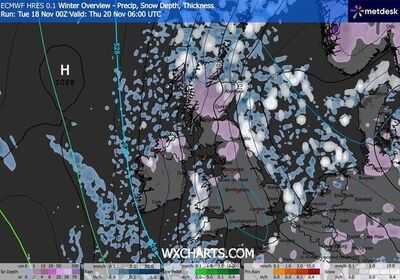
Heavy snow showers are likely to batter parts of the UK, weather maps turning white as far as Plymouth have suggested. The freezing weather conditions will lead to a massive drop in temperature levels in just days, with a possibility of unbearable -9C in a few areas, according to the maps.
The latest weather maps from WXCharts, which uses Met Desk data, show that areas even in the southern parts of the country will be peppered with snow on November 20 (Thursday). According to the weather charts generated on November 18, the wintry conditions will cover most areas in Scotland, however, many towns and cities in the Midlands along with Plymouth are also likely to be covered in the snow.
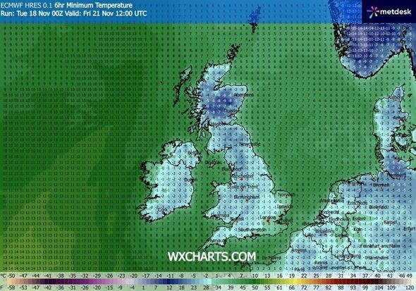
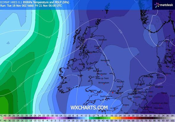
Another weather map, this time looking at November 21, suggests most of Britain will be hit by icy conditions, with most areas facing temperatures below 0. Areas of Scotlands may see temperatures as low as -9C, the maps suggested.
The unsettled conditions come as the Met Office issued amber warning of snow for several parts of Britain. Apart from this, multiple Yellow National Severe Weather Warnings for ice and snow have been issued for the coming days.
These warnings cover wide areas, including Northern Ireland, parts of Wales, northern and southwest England, as well as much of Scotland, with conditions expected to cause disruption and hazardous travel.
According to the maps, the wintry weather is likely to continue till Friday with the maps suggesting the temperature plummeting to -9C on Friday night at around 9pm in parts of Scotland.
The Met Office's weather forecast for Thursday to Saturday reads: "Sunny with wintry showers slowly easing on Thursday. Widespread frost and some ice at first, and again overnight. Rain spreading from the west during Friday and Saturday. Turning less cold."
Met Office Chief Forecaster Neil Armstrong said: "Cold Arctic air from the north is firmly in charge of the UK's weather, bringing the first notable cold snap of this autumn and giving an early taste of winter weather.
"As a result, winter hazards are likely through the next few days, with snow and ice a particular hazard, and the coldest conditions likely on Wednesday and Thursday. Wintry showers will affect areas exposed to the brisk northerly wind, in particular Northern Ireland, southwest Wales, southwest England, northeast England and across the northern half of Scotland.
"Whilst not all places will see lying snow, where showers are most frequent accumulations of 2-5 cm will be possible. On higher ground in Scotland, 15-20 cm could accumulate, and potentially as much as 15-25 cm over the North York Moors and Yorkshire Wolds."
-
Pregnant Indian-Origin Woman Killed In Sydney After BMW Collision; Teen Driver Charged

-
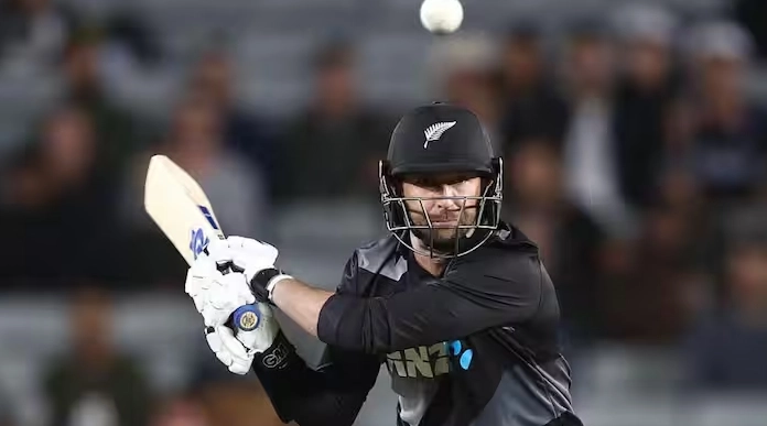
Daryl Mitchell’s 119 lifts New Zealand to a seven-run win over the West Indies in the 1st ODI

-
Ranveer Singh reflects on special fatherhood bond with Dhurandhar director Aditya Dhar: ‘He had a baby…’

-
Today Gold, Silver Rate November 19: Check 18, 22, 24 carat Gold prices in Chennai, Mumbai, Delhi, Kolkata

-
Devon Conway goes past 1,500 runs in ODIs: Key stats