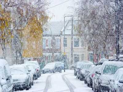
Heavy rain and wind may have dominated the weather this week but wintry conditions are forecast to return to parts of England from Monday.
The Met Office is forecasting a change in conditions over the weekend, with colder easterly winds developing, which will result in a drop in temperatures. While Saturday will still bring showers and strong winds, there is a chance of some hill snow in the north-east, and temperatures will be chilly, around 5C to 6C. Conditions are expected to turn even colder by Sunday, with a mix of showers in the north west and far south of England, with showers falling "increasingly" as sleet or snow in the north east, particularly on hills.
The wintry conditions are forecast to last into next week as a weather system from the Atlantic brings colder air to the UK on Monday, meaning possible snowfall in some areas.
While the forecast still remains uncertain, the Met Office says cold weather and snow is especially likely for parts of northern and north easterly parts of England.
Met Office maps also show some snowfall in parts of Scotland and Wales from Monday, while rain showers are also on the cards for large swathes of the country.
In its extended range UK weather forecast, the Met Office said: "Low pressure will remain the driving force for much of the weekend's weather, with a mixture of winds and rain for many through the weekend.
"While much uncertainty remains into the start of next week, there's a chance of wintry hazards at times, particularly in the north and east, with the possibility of snow for some.
"With an easterly influence, cold weather, especially for those in the northeast, is on the cards with the potential for snowfall accumulations in places, though it's too early to specify exact details."
A more detailed forecast for Monday and Tuesday adds: "As colder air becomes established, the next Atlantic system approaches on Monday, bringing a band of heavy rain into Northern Ireland, Wales and southwest England. However, as this encounters the colder air, it may turn to snow in places.
"The exact location depends on the orientation of the low pressure and subtle changes in its track. Some model simulations place the low slightly further south, increasing the chance of snow on its leading edge before turning back to rain. Others suggest a more northerly track with fewer wintry hazards."
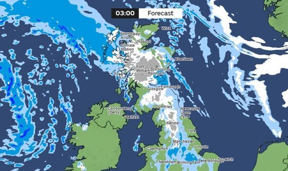
As the weather system from the Atlantic is still approaching, the forecast for next week could change, but Met Office maps currently show possible snow is forecast for these areas of England next week:
Monday- County Durham
- Cumbria
- North Yorkshire
- East Riding of Yorkshire
- Northumberland
- North Yorkshire
- South Yorkshire
- West Yorkshire
- Derbyshire