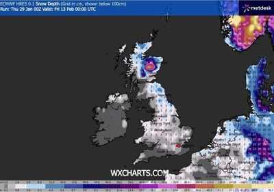
The latest weather maps show the UK will be hit by a huge 664-mile snow blizzard that is likely to reach as far south as London. Weather charts issued by WXCharts.com show snow across the country, from the far north of Scotland down to London and Bristol. Other areas likely to be hit are the north of England, the Midlands, and parts of the south west on February 12 and 13.
The snow blizzards forecast for those days could mean 10mm of snow per hour and a depth of at least 20cm across the whole country. Snow depths, however, could significantly increase in the north of Scotland, which could see more than a foot of snow in some areas near Aberdeen and Dundee. In England, the North-east could see up to 8cm. Heavy flurries, however, are also predicted on the maps across southern England at midnight on February 8, whilst a substantial purple zone indicates snowfall across the Midlands, Wales, northern England, and Scotland. Major cities, including Birmingham, Manchester, Newcastle, and Edinburgh, appear to be directly affected.
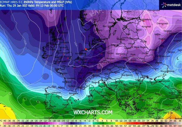
This is due to a 'Beast from the East' storm, indicating a significant snow mass forming east of Britain, which will then merge with another approaching from the south, resulting in nationwide snow coverage.
By midday on February 9, the maps indicate snow will have extended to Northern Ireland, affecting Belfast. The most significant snowfall is anticipated in north-eastern England during this period, with substantial flurries also impacting the north-west.
The Met Office long-range weather for February 13-27 says: "Something of a north-south split seems quite likely at first, with low pressure to the south and high pressure to the north, before a potential change back to more of a southwest-northeast split.
"With the jet stream likely further south than normal, the wettest conditions are more likely towards the south. Northwestern parts of the UK are most likely to be drier than normal.
"Whilst incursions of wet, windy and milder weather are favoured at times in the south and later the west, colder conditions further north will bring an increased risk of wintry hazards, especially where any precipitation from the southwest interacts with the cold air.
"The colder conditions may affect all parts at times, more especially early in this period."
England
Birmingham
Bristol
Carlisle
Chester
Coventry
Derby
Durham
Gloucester
Hereford
Kingston-upon-Hull
Lancaster
Leicester
Lichfield
Liverpool
Manchester
Newcastle-upon-Tyne
Nottingham
Oxford
Portsmouth
Preston
Ripon
Salford
Salisbury
Sheffield
Stoke on Trent
Sunderland
Wakefield
Wells
Winchester
Wolverhampton
Worcester
York
Northern Ireland
Armagh
Bangor
Belfast
Lisburn
Londonderry
Newry
Scotland
Aberdeen
Dundee
Dunfermline
Edinburgh
Glasgow
Inverness
Perth
Stirling
Wales
Bangor
Cardiff
Newport
St Asaph
St Davids
Swansea
Wrexham
-
What after Ajit Pawar? Maharashtra politics in conundrum

-
Is T20 World Cup In India At Risk Due To Nipah Virus Outbreak?

-
RCB Coach Addresses Virat Kohli’s Spin Bowling Challenges

-
Delhi Capitals Receive Major Boost as Faf du Plessis Returns to Full Fitness for IPL 2025

-
Abhishek Nayar Joins Mumbai South Central Maratha Royals as Mentor After IPL 2025 Stint with KKR