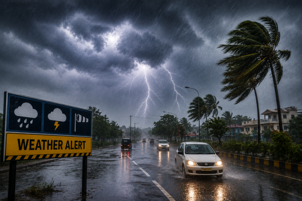
India is likely to witness another spell of unsettled monsoon weather on Sunday, August 9, with heavy rainfall, thunderstorms, lightning and gusty winds expected across several parts of the country. Northern, eastern and central India are likely to see particularly active weather conditions, while hilly regions need to remain alert to the possibility of landslides and disruption to road connectivity.
According to the weather outlook cited in the report, conditions could deteriorate across multiple regions over the coming hours. Wind speeds may reach 50-70 kmph at isolated locations, while heavy rain could increase the risk of waterlogging, falling trees, overflowing local streams and landslides.
Residents should therefore follow local weather advisories, particularly before travelling through vulnerable mountainous areas or spending extended periods outdoors during thunderstorms.
Weather Systems Could Intensify Rainfall
The expected increase in rainfall is linked to active weather systems over different parts of India.
A low-pressure area is expected to develop around Gangetic West Bengal and adjoining coastal areas of the northwest Bay of Bengal. An upper-air cyclonic circulation is also present around southwest Uttar Pradesh and neighbouring regions.
These systems could support increased rainfall activity over parts of eastern and central India.
Thunderstorms accompanied by lightning and strong surface winds may occur in some regions, making weather conditions potentially hazardous even where rainfall itself isn't exceptionally intense.
Rain and Thunderstorms Expected Across Multiple States
The August 9 forecast indicates unsettled weather across a wide geographical area.
Uttar Pradesh, Bihar, Delhi, Haryana, Rajasthan, Uttarakhand, Himachal Pradesh, Jammu and Kashmir, Jharkhand, West Bengal, Odisha, Madhya Pradesh, Chhattisgarh, Gujarat and Maharashtra are among the areas highlighted for rain or thunderstorm activity in the report.
Conditions will not necessarily be identical across every district in these states. Some locations could experience moderate showers, while isolated areas may receive heavier rainfall accompanied by thunderstorms and strong winds.
People working outdoors, particularly farmers, should remain alert to lightning warnings.
Delhi Weather on August 9
Delhi could receive another spell of rain on Sunday, accompanied by gusty winds.
According to the forecast cited in the report, wind speeds in the capital may reach around 30-40 kmph during stormy conditions.
Delhi's maximum temperature is expected to remain close to 34°C, while the minimum could settle near 24°C.
Rain may provide some relief from humid conditions, but intense showers could lead to temporary waterlogging and traffic disruption in vulnerable locations.
Commuters should check current traffic and weather conditions before travelling.
Uttar Pradesh Could See Widespread Rain
Several districts of Uttar Pradesh could experience rain and thunderstorms on August 9.
Areas highlighted in the forecast include Meerut, Hapur, Noida, Mathura, Agra, Bulandshahr, Aligarh, Jhansi, Etawah, Firozabad, Kanpur, Sonbhadra, Mirzapur, Ghazipur, Ballia, Banda, Prayagraj, Gorakhpur and Deoria.
Wind speeds could reach approximately 50-55 kmph in some areas during thunderstorms.
Lucknow is expected to record a maximum temperature of around 34°C and a minimum of approximately 28°C.
The weather circulation around southwest Uttar Pradesh and neighbouring areas could contribute to increased rainfall activity.
Bihar Faces Heavy Rain and Thunderstorm Risk
A number of Bihar districts may also experience active monsoon conditions.
The report highlights Gaya, East Champaran, West Champaran, Rohtas, Nawada, Banka, Lakhisarai, Munger, Nalanda, Buxar, Siwan, Vaishali, Muzaffarpur, Samastipur, Darbhanga, Madhubani, Purnia, Araria, Kishanganj, Katihar, Begusarai, Saharsa and Supaul.
Thunderstorms and heavy rainfall could occur in parts of these areas.
Patna's temperature is expected to range between approximately 28°C and 34°C.
Lightning remains an important risk during monsoon thunderstorms, so people should avoid open fields and isolated trees when thunder is heard.
Jharkhand Weather: Winds May Reach 60 Kmph
Jharkhand could also see thunderstorms accompanied by heavy rain in some locations.
Ranchi, Ramgarh, Bokaro, Hazaribagh, Jamshedpur, Palamu, Khunti and Dumka are among the areas highlighted in the forecast.
Gusty winds could reach around 50-60 kmph during intense weather.
Ranchi may see a maximum temperature of approximately 30°C, while the minimum could remain near 23°C.
Uttarakhand Needs to Stay Alert for Landslides
Rainfall in mountainous terrain can create hazards beyond waterlogging.
Parts of Uttarakhand, including Bageshwar, Rudraprayag, Nainital, Haridwar, Rishikesh, Pithoragarh, Almora and Pauri Garhwal, could receive moderate to heavy rain.
Winds may reach around 30-40 kmph at some locations.
Dehradun is expected to see temperatures between approximately 26°C and 30°C.
People travelling through mountainous districts should be cautious of landslides, falling rocks and sudden disruption to roads during periods of intense rainfall.
Himachal Pradesh Could See Winds Up to 70 Kmph
Himachal Pradesh is another state where potentially disruptive weather is expected.
A yellow alert has been highlighted for parts of the state, with Kangra, Sirmaur, Shimla, Mandi, Chamba, Kullu and Solan among the districts that could experience moderate to heavy rainfall.
Strong winds may reach as high as 70 kmph at isolated locations, according to the forecast cited in the report.
Travellers heading towards hill stations should monitor local advisories because heavy rain can rapidly affect mountain roads.
Jammu and Kashmir May See Heavy Rain
Rain and thunderstorms are also forecast across parts of Jammu and Kashmir.
Areas including Poonch, Kulgam, Jammu, Kathua, Shopian, Doda, Rajouri, Kishtwar and Anantnag have been highlighted for potentially adverse weather.
Srinagar could record a maximum temperature of around 28°C and a minimum close to 18°C.
In vulnerable mountainous areas, intense rainfall may increase the possibility of landslides and sudden rises in water levels.
Punjab and Chandigarh Could Get Another Wet Spell
Parts of Punjab and Chandigarh could also receive moderate to heavy rainfall.
The report highlights Hoshiarpur, Bathinda, Kapurthala, Mohali, Patiala, Sangrur, Barnala and Amritsar, along with Chandigarh.
Gusty winds could reach approximately 65 kmph in some areas.
Farmers should avoid unnecessary exposure in open fields when thunderstorms and lightning are active.
Rajasthan Weather: Jaipur, Alwar and Several Districts on Alert
Rainfall and thunderstorms are also expected across several parts of Rajasthan.
The forecast highlights Jhunjhunu, Sikar, Churu, Kota, Jalore, Bharatpur, Ajmer, Udaipur, Jaisalmer, Jaipur, Tonk, Dausa and Alwar.
Some areas could experience winds reaching approximately 65 kmph during storm activity.
Jaipur is forecast to see a maximum temperature near 30°C, while the minimum may remain around 24°C.
Residents should remain cautious around trees, temporary structures and electricity poles during strong winds.
Madhya Pradesh Could See Rain Across Several Districts
Rainfall activity may remain widespread across parts of Madhya Pradesh as well.
Vidisha, Narsinghpur, Chhindwara, Balaghat, Rewa, Indore, Bhopal, Katni, Damoh, Panna, Tikamgarh, Jabalpur, Seoni, Bhind and Chhatarpur are among the locations highlighted for moderate to heavy rain.
Strong winds could reach approximately 60 kmph in some areas.
Bhopal is expected to record a maximum temperature around 28°C and a minimum close to 24°C.
August 9 Temperature Forecast for Major Cities
| City | Maximum Temperature | Minimum Temperature |
|---|---|---|
| Delhi | 34°C | 24°C |
| Mumbai | 32°C | 27°C |
| Chennai | 37°C | 27°C |
| Kolkata | 32°C | 27°C |
| Lucknow | 34°C | 28°C |
| Patna | 34°C | 28°C |
| Ranchi | 30°C | 23°C |
| Bhopal | 28°C | 24°C |
| Jaipur | 30°C | 24°C |
| Shimla | 28°C | 19°C |
| Nainital | 24°C | 18°C |
These temperatures are forecasts and can change depending on local cloud cover, rainfall and other weather conditions.
What Should You Do During Heavy Rain and Thunderstorms?
People in affected regions should keep an eye on the latest official warnings and avoid unnecessary travel when severe weather develops.
During thunderstorms, avoid standing under isolated trees, near electricity poles or in open fields. Move indoors when lightning activity increases.
Drivers should reduce speed during intense rain because visibility can deteriorate rapidly and roads may become slippery or waterlogged.
In hill states, avoid travelling through landslide-prone stretches during very heavy rainfall unless necessary. People living near rivers, streams and reservoirs should also monitor local warnings if water levels begin rising.
Weather Conditions May Change Quickly
The August 9 forecast points to another active phase of the monsoon across northern, eastern and central India, with heavy rain, thunderstorms and strong winds possible across several states.
Himachal Pradesh could see particularly strong gusts reaching around 70 kmph at isolated locations, while parts of Rajasthan, Punjab, Uttar Pradesh, Jharkhand and Madhya Pradesh could also experience strong winds with rain.
Since thunderstorm location and intensity can change over a short period, residents should treat district-level forecasts as guidance rather than a guarantee of identical weather everywhere.
For the latest warnings before travelling, check updates issued by the India Meteorological Department and local authorities, particularly in areas vulnerable to lightning, flash flooding and landslides.
-
‘It’s for the future’ - Lionesses star Lucy Bronze stays firm on possible UEFA World Cup boycott

-
Lionel Messi mourns father Jorge, his lifelong pillar of support

-
Lionel Messi mourns father Jorge, his lifelong pillar of support

-
Your Zodiac Sign’s Horoscope Is Here For Sunday, August 9, 2026

-
World’s second most visited country ranked most booked destination in Europe this year