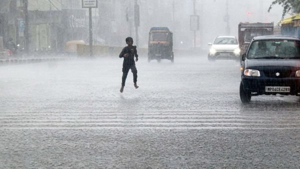
While the humidity and scorching heat across the country had forced people to think that this year's monsoon has bid its final farewell, on the other hand nature has brought an unexpected and shocking turn in the weather patterns. According to the latest assessment of the Indian Meteorological Department (IMD) and modern weather forecast models, the south-west monsoon is in no mood to depart from the entire country. Even though there are signs of normal withdrawal of monsoon winds from the north-western tip, a new weather system suddenly emerging in the Bay of Bengal has changed the entire scenario. Meteorologists say that the monsoon is going to give a big surprise of heavy rain to a large part of the country. Many districts of Uttar Pradesh, Bihar, Madhya Pradesh, Odisha, Jharkhand and Chhattisgarh will see such a gathering of clouds in the coming days, due to which not only the water level of rivers and streams can rise again, but there will also be a huge drop in day and night mercury. 5 days of torrential rain from 24 to 28 September: New low-pressure system becoming active in the Bay of Bengal. Fresh satellite images and latest simulation of Artificial Intelligence based Weather Forecasting System (AIFS) have alerted the analysts of the Meteorological Department. According to the report, a very strong low-pressure area is going to take shape over the central and northern parts of the Bay of Bengal during September 24 to September 28. Due to favorable atmospheric conditions, there is a strong possibility of this system becoming more intense and turning into a depression or cyclonic storm. As this low pressure area draws moisture from the ocean and moves towards the Indian landmass, a dense blanket of clouds will spread over eastern and central India for 5 consecutive days. The effect of this seasonal change will be that the monsoon, which had been quiet for the last few days, will suddenly revive and a new spell of torrential rains accompanied by strong thunderstorms, loud thunder and lightning will begin. From Odisha to UP-Bihar and Chhattisgarh: In which states will the weather conditions worsen? The track and possible spread of this new weather system is going to directly affect many states of the country. According to meteorologists, this cyclonic circulation originating in the Bay of Bengal will initially move in the north-west direction, due to which the first and direct hit will be on Odisha and coastal Andhra Pradesh. After this, this system will move forward and pass through the plains of Southern Chhattisgarh, Jharkhand and Bihar. There is a possibility of widespread movement of clouds and intermittent heavy to very heavy rains over Purvanchal and Terai belt of Uttar Pradesh—especially Gorakhpur, Varanasi, Prayagraj, Ayodhya, Basti, Gonda and the capital Lucknow. On the other hand, a warning has been issued in Bihar's districts like Patna, Gaya, Bhagalpur and Purnia about heavy monsoon showers and water logging after September 24. Along with this, there is a possibility of increase in heavy rain activities in the last phase of this system in Assam, Meghalaya and Arunachal Pradesh of North-East India. Farewell in the North-West and Trouble in the East: Collision of Anti-Cyclone and Monsoon Trough The most unique feature of this time's monsoon is its dual character, which has surprised even the weather experts. On one hand, there will be heavy rains in Eastern and Central India from September 24 to September 28, while on the other hand, completely opposite conditions are being created in the states of North-Western India. The process of withdrawal of monsoon has gradually started gaining momentum around 15 to 19 September through Jaisalmer, Barmer and Bikaner of Rajasthan. A massive anti-cyclone is likely to develop over northwest India and northern Arabian Sea after September 25. This anti-cyclone will push dry north-westerly winds, due to which the weather will remain completely clear and dry over western Rajasthan, Punjab and western parts of Haryana. But as soon as these dry winds collide with the extremely moist monsoon winds coming from the east, intense convection will occur in the border areas of Uttar Pradesh and Madhya Pradesh, which may increase the incidence of sudden severe thunderstorms and lightning. Monsoon will knock cold on its way: drop in night temperature and beginning of pink winter. This five-day rain in the last week of September will not only soak the land, but will also completely change the weather cycle. Due to this continuous rain and cloud cover in the sky, there is a possibility of a huge drop in the maximum temperature of the day by 4 to 6 degrees Celsius. Along with this, as soon as the humidity level decreases, the night temperature will start feeling quite cool from the first week of October. This monsoon rain in the plains of North India, especially Uttar Pradesh, Delhi-NCR, Haryana and Rajasthan, will eventually lay the foundation for the formal beginning of 'pink winter' (mild cold). The season of light mist in the morning and slow fan speed at night is expected to begin soon after the passage of this system. Effect of last rain on Kharif crops: What is the special warning of the Meteorological Department for farmers? This unexpected U-turn of the weather has drawn lines of worry on the forehead of the farmers. At present, major Kharif crops, especially paddy, maize, millet, oilseeds and pulses, are in the critical stage of ripening or harvesting in the fields across the country. Agricultural scientists have warned that if there is excessive rainfall with strong winds between September 24 and 28, ripe paddy ears standing in the fields may fall, causing huge damage to the crops. Farmers in Bihar, Eastern Uttar Pradesh and Chhattisgarh have been advised not to leave harvested crops in open barns and immediately make concrete arrangements to cover them with safe tarpaulins or in warehouses. Apart from this, ensure proper drainage of excess water from the fields in advance so that the roots of the crops do not rot due to waterlogging. Advisory of IMD and AI weather model: Advice to be cautious for the next 5 to 7 days. The Directorate General of Meteorological Department has issued instructions to the State Disaster Management Authorities and local administration to remain alert. Since the seasonal systems in the Bay of Bengal change their direction and intensity rapidly even with small changes in the atmosphere, they are being monitored round the clock through real-time satellite radar. General citizens have been advised to check the daily bulletin of the Meteorological Department and thunderstorm warning on Meghdoot or Damini app before undertaking any long distance journey during the period from 24 to 28 September. People living in riverine areas have been given strict instructions to remain alert and not to take shelter in open fields or under big trees during strong thunderstorms and lightning. Monsoon is ready to show its full strength with its departure, in such a situation complete vigilance is the biggest measure of safety.
-
Frank Lampard remains secure despite Coventry City's dreadful start — Doug King knows better than to panic

-
Gold Prices Plunge; What’s the Status of Silver Today? Check the Latest Rates for September 15

-
UPI: If a 0.3% charge is applied, how much will be deducted for a ₹2,500 bill payment? Understand the full calculation.

-
Major Update for Android Users! Google May Soon Alter This Security Feature

-
How much electricity does a 2kW solar panel generate per month, and what are the savings?